Adding Field Attributes
Field Attribute lines and points may be added manually at the Field Boundary level.
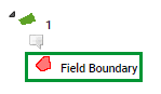
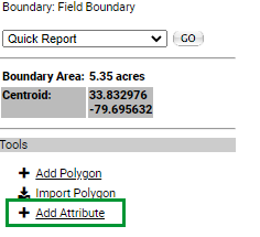
- Navigate to the Field Level Boundary and click on the "Field Boundary" layer
- Click the "Add Attribute" button found in the right gray pane.
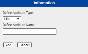
- The "Information" window will pop up. Define the Attribute type(Line or Point),Define Attribute Sub-type(Only Point) and Define the Attribute Name.
- The Attribute will now be listed in the right hand pane under "Point and Line Attributes"
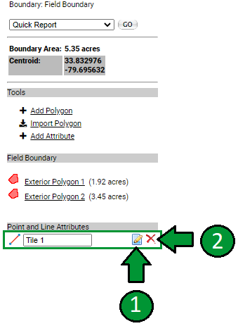
- Click the "Edit"[1] icon to the right of the attribute to place or edit the attribute. To delete the attribute, click the "Red X"[2] icon
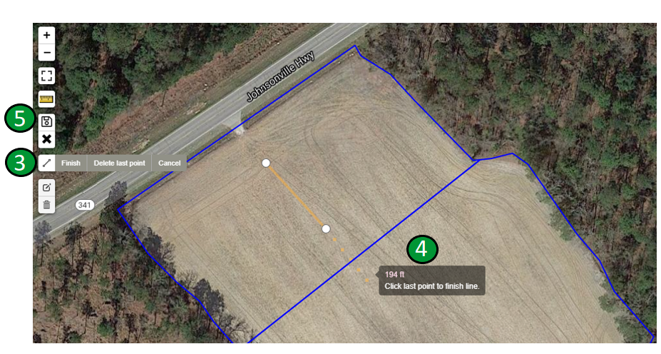
- After clicking the "Edit" icon the editing tools will be made available in the top left corner of the map.
- Click the "Draw Polyline"[3] icon and place a vertex by left clicking, after the first vertex is placed a box will follow with the cursor displaying the distance[4] from the starting point.
- To "Finish" the line at the pointer double left click or Click the Last vertex to finish the line. Use the "Edit Layers" button to make edits to the line or point.
- If placing a point, click the "Draw Marker"[3] button and left click to place the point.
- Click the floppy disk "Save"[5] icon to save the attribute.
- The attribute will now display on the Map with the Field Boundary layer selected.
|
|


