Map Right- Click Options
Right clicking within the map view on the main tab of FieldAlytics will display the following options. See below for a brief description of what each option does.
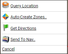
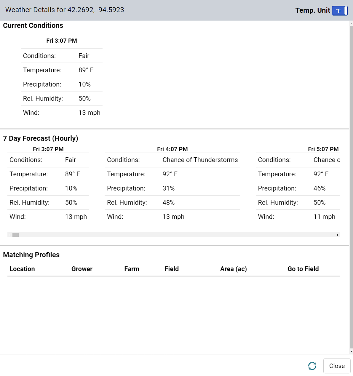
- Query Location : Query Location will display the current weather and 7 day forecast for the clicked location. Fahrenheit or Celsius units can be toggled using the slider in the upper right hand corner.
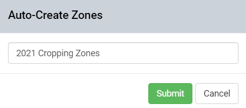
- Auto-Create Zones: Right clicking over the field shows "Auto-Create Zones" option. This option will create a management zone that covers the entire field. Select this operation then give the management zone a name & click "Submit"
- Send to Nav: Send to Nav will allow the point to be sent to a Garmin, Wireless Garmin, or Tom Tom device for turn-by turn direction. Simply input which type of device and name the destination point.
Please Note: Send to Nav requires Garmin Browser Plugin, Garmin Nuvi 1690, or Tom Tom Home to be installed .
|
|
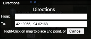
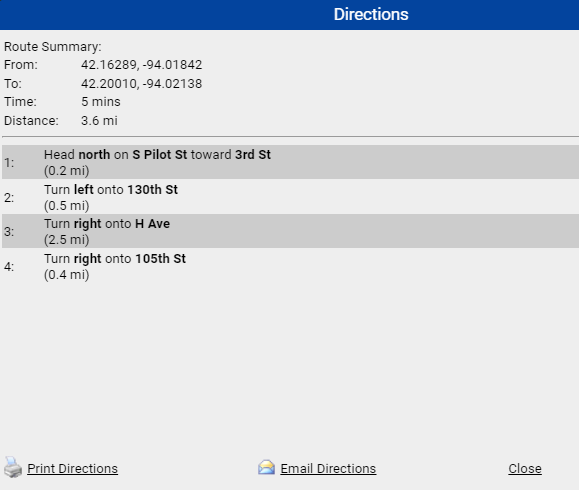
- Get Directions: Once this option is selected, the point of click becomes the destination and a black box will appear with Lat/Long of first point. Right-click anywhere on the map To set a beginning point for navigation. Select then click the button that appears within the black "Directions "box. The system will then open a "Directions" screen with summary information, directions and print/email buttons.
|
|


